
OT-Wednesday 2/7 Weather Thread
- Thread starter Knight Shift
- Start date
You are using an out of date browser. It may not display this or other websites correctly.
You should upgrade or use an alternative browser.
You should upgrade or use an alternative browser.
I'm supposed to fly to Nebraska on Wednesday night to explore the area for a bit before the MBB game on Saturday. How delayed will my flight be? (Too bad the Eagles parade is Thursday because I was banking on it being Tuesday or Wednesday and I wanted to party with my close friends again.)

A thread for a different event. All I ask.A thread for "rain slush". Seriously?
What happens in said event is up to the Great Meteorologist in the sky decision.

5" in Sussex is not all slush.
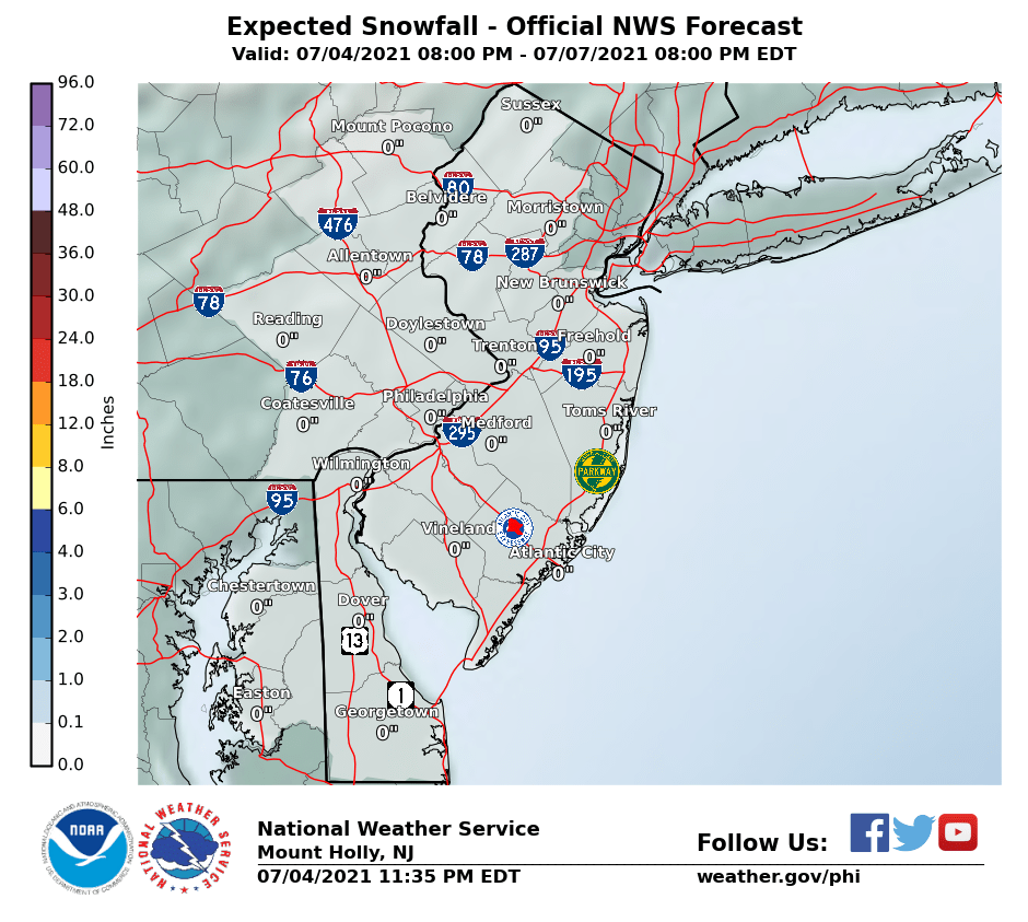
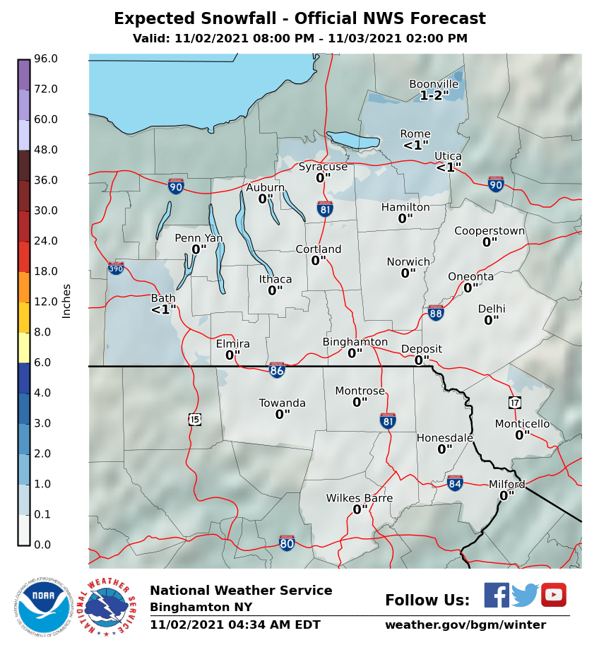
And the Southern Tier of NY is going to get quite a bit:
As for @LadyRU09 , looks like all rain near NYC.
http://forecast.weather.gov/MapClick.php?lat=40.71455000000003&lon=-74.00713999999994#.WnkTU-dG3b0
And the Southern Tier of NY is going to get quite a bit:
As for @LadyRU09 , looks like all rain near NYC.
http://forecast.weather.gov/MapClick.php?lat=40.71455000000003&lon=-74.00713999999994#.WnkTU-dG3b0


Here in Scranton they are telling us 4 to 8 inches of snow for Wednesday. We just got an inch overnight (Tuesday) that no one predicted, probably lake effect I guess.it's looking like there will be quite a bit of snow in the Poconos and further west/north.
Here in Scranton they are telling us 4 to 8 inches of snow for Wednesday. We just got an inch overnight (Tuesday) that no one predicted, probably lake effect I guess.
My favorite prediction by weather forecasters and they pat themselves on the back.
We may get 4 inches but we may also get 8 inches. So 100 percent more or double their prediction and that's considered an accurate prediction!! SMH.
s considered an accurate prediction.
A thread for "rain slush". Seriously?
You posted a map of Syracuse to defend your slush thread? Seriously?
When it comes to Scranton we are sort of used to that due to the geography here. The city portion of Scranton is down in a valley, surrounded by mountains of about 2000 ft to the east and west. The city usually gets less snow than the mountainous areas where there are a lot of residential houses.My favorite prediction by weather forecasters and they pat themselves on the back.
We may get 4 inches but we may also get 8 inches. So 100 percent more or double their prediction and that's considered an accurate prediction!! SMH.

Looks like this from Dan Zarrow. Precip starting after morning rush hour ending late Wed nite
Far North Jersey snow 3-7 inches
Northern NJ north of 78 mix to rain by afternoon 1-3/ice
North Central NJ between 78 and 195 Quick hit of snow then rain coating to an inch/ice
Inland Southern NJ along 295 Quick hit of mix then rain coating
Coastal NJ Rain
Far North Jersey snow 3-7 inches
Northern NJ north of 78 mix to rain by afternoon 1-3/ice
North Central NJ between 78 and 195 Quick hit of snow then rain coating to an inch/ice
Inland Southern NJ along 295 Quick hit of mix then rain coating
Coastal NJ Rain
I'm anticipating Great Fun, having driven up to Boston last night (for all you Cannonballers out there - Manalapan to Boston in 4 hours flat). I'm wrapping up here tomorrow afternoon and it looks like the trip home is going to be a total shitshow. The prog maps are showing snow/mix/ice throughout the I95 corridor.
actual boston or some burb?I'm anticipating Great Fun, having driven up to Boston last night (for all you Cannonballers out there - Manalapan to Boston in 4 hours flat). I'm wrapping up here tomorrow afternoon and it looks like the trip home is going to be a total shitshow. The prog maps are showing snow/mix/ice throughout the I95 corridor.
I used to drive up from NB area regularly.. 4 is a nice time.. I used to do the inland route to Framingham area.. Tappan-Zee-684-84.. I think it is all called 84 now. Maybe you can avoid the ice that way and stick to the snow. Of course you might also lose out on the possibility of getting lucky with all rain.
actual boston or some burb?
I used to drive up from NB area regularly.. 4 is a nice time.. I used to do the inland route to Framingham area.. Tappan-Zee-684-84.. I think it is all called 84 now. Maybe you can avoid the ice that way and stick to the snow. Of course you might also lose out on the possibility of getting lucky with all rain.
Burlington, so just a few klicks west.
I came up 95 as far as New Haven, then shot up 91 to 84 and back onto 95 for the last 13 miles. I would have come in well under 4 hours if it weren't for the Cross Bronx. Once I hit Connecticut, I wasn't under 90 at any point in time.

did anyone else get the Tsunami warning today? No joke, it went out accidentally, my wife was freaking out.
http://www.delmarvanow.com/story/news/local/2018/02/06/glitch-causes-tsunami-warning/310446002/
http://www.delmarvanow.com/story/news/local/2018/02/06/glitch-causes-tsunami-warning/310446002/
did anyone else get the Tsunami warning today? No joke, it went out accidentally, my wife was freaking out.
http://www.delmarvanow.com/story/news/local/2018/02/06/glitch-causes-tsunami-warning/310446002/
There's something close to a zero chance of a tsunami in this part of the world, ever.

yawn...never was a big believer in this system Here is the new Mt Holly snow map...precip will break out tomorrow morning...and we could luck out and it breaks out after the morning rush. I would watch for any time changes with the start before you head out tomorrow morning
Going to start out as a period of snow for most of us except the shore and south jersey with some mixing of sleet and freezing rain and then a change to all rain in the afternoon. Around the I 95 corridor its looking like an inch or less of slushy stuff...north of 78 you start to get into the 1-3 amounts and then 3-5 inch amounts possible north of 80 and the usual spots in NW NJ. Start time looks anywhere from 7AM -10AM...hopefully it gets pushed later and that would then minimize any
rush hour impact
High pressure briefly re-establishes itself this evening before
retreating to the north and east overnight as the next system
approaches. This next system will be a fairly moisture laden low
that will move from eastern Texas north and east to a position
near eastern Tennessee by Wednesday morning. Clouds will thicken
up overnight ahead of this system and its associated warm front
meaning once again lows may occur early before temps nudge up
overnight. Generally looking at lows in the 20s to low 30s
except upper teens across the southern Poconos. There are some
model differences regarding the details of exactly when precip
arrives but this generally looks to occur near 12z Wednesday so
we begin to ramp up POPs near dawn. Track of low will favor
mixed precipitation (snow, sleet, freezing rain) initially
developing near the I-95 corridor with mainly rain farther south
and east and mainly snow to start north and west. Bulk of the
event occurs during Wednesday so for further details, please see
below.
&&
.LONG TERM /WEDNESDAY NIGHT THROUGH MONDAY/...
The focus for the long term is on two storm systems that are
expected to bring widespread moderate precip to the region with
the first round on Wednesday and the second round late in the
weekend.
Wednesday and Wednesday night...The first low is expected to
track to the NE along a warm front, eventually passing through
the northern Mid-Atlantic states Wednesday afternoon-evening.
Models have converged toward an I-95 storm track across our
area, which signals a general wintry mix as well as introduces a
plethora of ptype questions given the complexity of the setup.
The pattern is not too dissimilar to what we saw on Sunday
although the air mass leading up to the next event looks to be
initially colder. Accordingly, precip will likely begin as snow
near and north of the Mason-Dixon line before warmer air aloft
moves in and causes a changeover to sleet/freezing and
eventually to rain. The transition to a wintry mix and then to
rain will likely occur rather quickly Wednesday morning in the
coastal plain and I-95 corridor. Even though snow and ice
accumulations are currently forecast to be minor for the I-95
corridor, the timing of the wintry mix being coincident with the
morning commute could maximize travel impacts. After the
transition to rain occurs later Wednesday morning, rainfall
amounts of one-half to one inch through Wednesday evening could
potential cause minor, poor-drainage flooding.
The potential to see a longer duration of snow, sleet and
freezing (as well as higher accumulations) increase quickly the
farther N/W you travel given the most likely track of the 850 mb
and surface lows. The greatest forecast uncertainty lies in the
area from roughly the Fall Line, northward to the I-80
corridor, where any small shifts in the track from the current
forecast could yield significant changes to the forecast (ptype
and snow/ice accumulations). There is a Winter Storm Watch for
our far northern counties along/north of I-80 and west of I-287
(Carbon and Monroe Counties in NE PA and for Sussex County in
far NW NJ) with at least the potential for 4-7 inches of
snow/sleet and around one tenth inch of ice.
https://www.weather.gov/phi/winter
Going to start out as a period of snow for most of us except the shore and south jersey with some mixing of sleet and freezing rain and then a change to all rain in the afternoon. Around the I 95 corridor its looking like an inch or less of slushy stuff...north of 78 you start to get into the 1-3 amounts and then 3-5 inch amounts possible north of 80 and the usual spots in NW NJ. Start time looks anywhere from 7AM -10AM...hopefully it gets pushed later and that would then minimize any
rush hour impact
High pressure briefly re-establishes itself this evening before
retreating to the north and east overnight as the next system
approaches. This next system will be a fairly moisture laden low
that will move from eastern Texas north and east to a position
near eastern Tennessee by Wednesday morning. Clouds will thicken
up overnight ahead of this system and its associated warm front
meaning once again lows may occur early before temps nudge up
overnight. Generally looking at lows in the 20s to low 30s
except upper teens across the southern Poconos. There are some
model differences regarding the details of exactly when precip
arrives but this generally looks to occur near 12z Wednesday so
we begin to ramp up POPs near dawn. Track of low will favor
mixed precipitation (snow, sleet, freezing rain) initially
developing near the I-95 corridor with mainly rain farther south
and east and mainly snow to start north and west. Bulk of the
event occurs during Wednesday so for further details, please see
below.
&&
.LONG TERM /WEDNESDAY NIGHT THROUGH MONDAY/...
The focus for the long term is on two storm systems that are
expected to bring widespread moderate precip to the region with
the first round on Wednesday and the second round late in the
weekend.
Wednesday and Wednesday night...The first low is expected to
track to the NE along a warm front, eventually passing through
the northern Mid-Atlantic states Wednesday afternoon-evening.
Models have converged toward an I-95 storm track across our
area, which signals a general wintry mix as well as introduces a
plethora of ptype questions given the complexity of the setup.
The pattern is not too dissimilar to what we saw on Sunday
although the air mass leading up to the next event looks to be
initially colder. Accordingly, precip will likely begin as snow
near and north of the Mason-Dixon line before warmer air aloft
moves in and causes a changeover to sleet/freezing and
eventually to rain. The transition to a wintry mix and then to
rain will likely occur rather quickly Wednesday morning in the
coastal plain and I-95 corridor. Even though snow and ice
accumulations are currently forecast to be minor for the I-95
corridor, the timing of the wintry mix being coincident with the
morning commute could maximize travel impacts. After the
transition to rain occurs later Wednesday morning, rainfall
amounts of one-half to one inch through Wednesday evening could
potential cause minor, poor-drainage flooding.
The potential to see a longer duration of snow, sleet and
freezing (as well as higher accumulations) increase quickly the
farther N/W you travel given the most likely track of the 850 mb
and surface lows. The greatest forecast uncertainty lies in the
area from roughly the Fall Line, northward to the I-80
corridor, where any small shifts in the track from the current
forecast could yield significant changes to the forecast (ptype
and snow/ice accumulations). There is a Winter Storm Watch for
our far northern counties along/north of I-80 and west of I-287
(Carbon and Monroe Counties in NE PA and for Sussex County in
far NW NJ) with at least the potential for 4-7 inches of
snow/sleet and around one tenth inch of ice.
https://www.weather.gov/phi/winter

Well if you look quickly, the Weather Channel's website shows a tsunami warning for New Brunswick until 11:59am so credit to them for still reporting fake news that was sent in error hours ago.
My favorite prediction by weather forecasters and they pat themselves on the back.
We may get 4 inches but we may also get 8 inches. So 100 percent more or double their prediction and that's considered an accurate prediction!! SMH.
s considered an accurate prediction.
The only job with less accuracy requirements: Mel Kuiper.

"Hi! I'm Mel Kuiper and I have the easiest job in the world. I am almost never right but am regarded as an expert anyway."
What's this about wet models?models seemed to trend wetter not whiter this morning
What's this about wet models?
I don't think that's happening for a while. Brady lost.


Wait a minute. I thought we settled this New Jersey "area" thing. Now we have to deal with North Central and Inland Southern? And they sound like railroads for cryin' out loud. what's next, Central Shore; Southern Shore; South Central?Looks like this from Dan Zarrow. Precip starting after morning rush hour ending late Wed nite
Far North Jersey snow 3-7 inches
Northern NJ north of 78 mix to rain by afternoon 1-3/ice
North Central NJ between 78 and 195 Quick hit of snow then rain coating to an inch/ice
Inland Southern NJ along 295 Quick hit of mix then rain coating
Coastal NJ Rain

Would never break through the ice dam on the Delaware River anyway.There's something close to a zero chance of a tsunami in this part of the world, ever.


Latest
-
01
 The Knight Report
Rutgers Football HC Greg Schiano talks Wisconsin game week
-
02
 The Knight Report
Join The Knight Report TODAY and get it for 60% off!
-
03
 The Knight Report
Rutgers Athletics launches "Rutgers Tough" fundraising campaign
-
04
 The Knight Report
ESPN BPI projects Rutgers Basketball's 2026-27 schedule
-
05
 The Knight Report
Rutgers Women's Basketball Head Coach Gary Redus II recaps LIU win