WHAT ARE YOU SAYING DON'T YOU WANT PEOPLE POSTING ON THIS THREAD WHY ARE YOU REPRESSING US
lol,..
WHAT ARE YOU SAYING DON'T YOU WANT PEOPLE POSTING ON THIS THREAD WHY ARE YOU REPRESSING US
I provided some models and they won't change much.and the models will change again.they always do
We'll allow your attempted hijacking of the thread, lol...I provided some models and they won't change much.
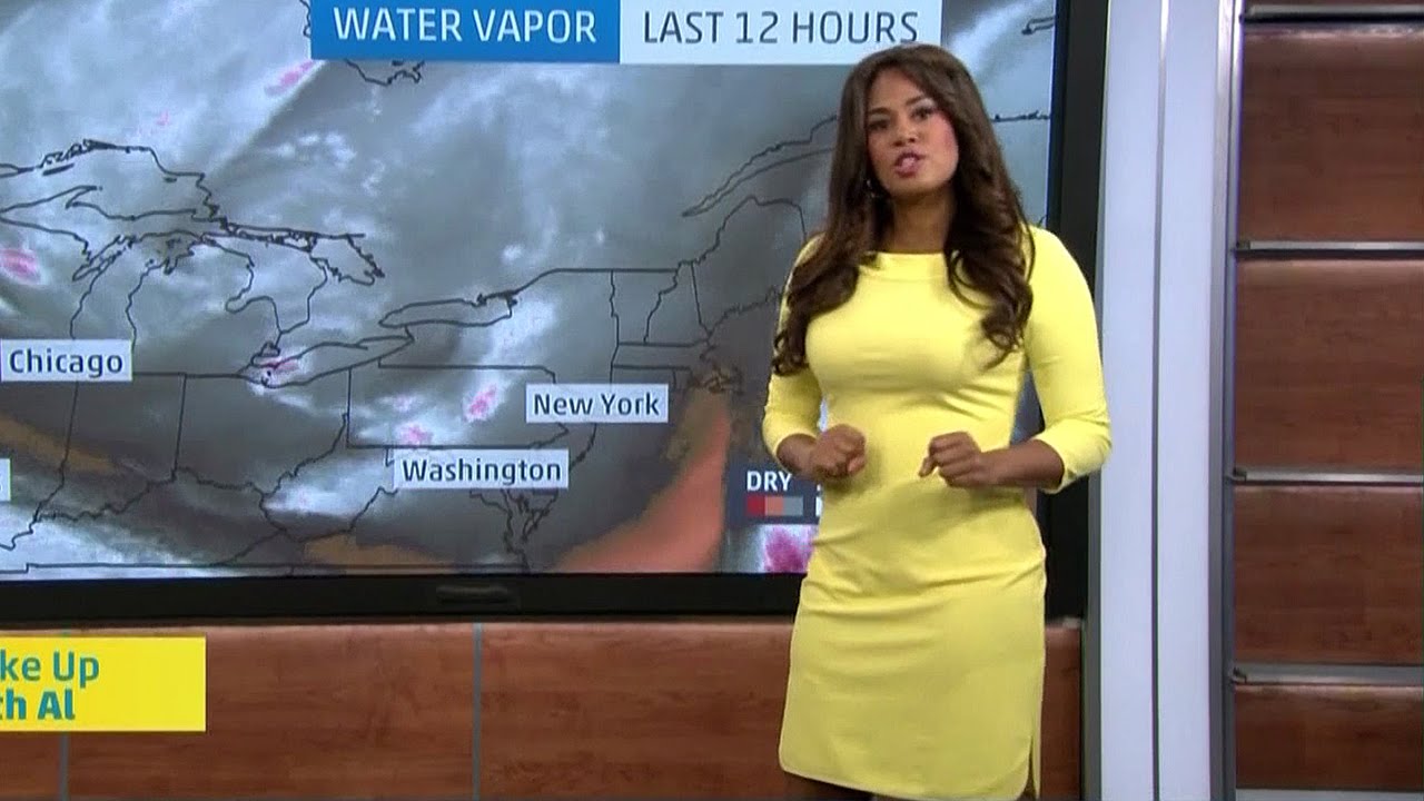

I like Yanet better.
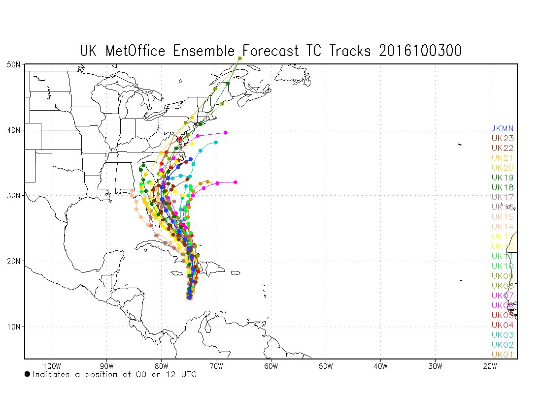
So... not to start a thing, but... The one ensemble model that's been most consistent the last several days is the UKMET.
To quote a great movie, "I've pulled Ted Stryker's record. You're not gonna like it."
Ukie has been consistent with its far westward solution, but I don't recall a tropical system where the UK was an outlier and verified. Doesn't mean it's not possible, as the UK is one of the 3 best models for hurricane tracks (Euro is still the best and GFS is the other in the top 3), but it's unlikely.
Those poor folks on those islands. How does this rank historically with other Atlantic storms? Hope the models are right with the OTS solution.
If it hits the east end of Cuba and grazes the west end of Haiti at about 125 mph, as forecast, that's a major hurricane, but nowhere near the worst either country has ever seen; same for the Bahamas. Still, it's going to be pretty impactful, especially for Haiti, which will be on the strong side of the storm and is a country with little to no infrastructure to deal with hurricanes (Cuba is generally very well prepared). Out to sea continues to be the most likely outcome.
Edit: just saw the graphic for estimate rainfall from Matthew in these islands and some mountainous areas could get 20-30 or even 40" of rain and many other areas are likely to get 10-20" - that kind of rainfall could be catastrophic, with killer mudslides and flooding and that rainfall won't be limited to just areas close to the storm, as per the map below. In addition, of course, closer to the storm, there will be major storm surges and hurricane force winds, although the worst of the winds only extend out 40-50 miles from the center, which is kind of unusual.

Tropical vs. otherwise aside, you'll recall how I stuck by the NAM for the January snowstorm last winter. They'll all wrong, until they're right.
Not saying that the Ukie is right, but if the next GFS ticks west again...
I just pray Matthew doesn't make landfall ANYWHERE, as it seems like a major storm in the Cat 4/5 range.
That aside, is it fairly certain that the storm will not have any impact at all on our game in NJ on Saturday?
Latest GFS came in west.
Euro has come in west.
Yeah, this is starting to look like a thing. Expect to see NHC's Cone of Terror shifted west at 5PM.


I will see your Matthew and raise you Yanet and quite possibly somebody else who is highly educated, sin duda.

And the Gulf looks safe, too.

My connections are solid.

Here she is in Rutgers colors.


Enough about it impacting the game, I'm more concerned about it hitting the coast!
I just pray Matthew doesn't make landfall ANYWHERE, as it seems like a major storm in the Cat 4/5 range.
That aside, is it fairly certain that the storm will not have any impact at all on our game in NJ on Saturday?
Not good, many show a direct hit to the Jersey Shore
The struggle is real. Keep the faith.WHAT ARE YOU SAYING DON'T YOU WANT PEOPLE POSTING ON THIS THREAD WHY ARE YOU REPRESSING US

As expected, updated guidance from NHC:
Just ran to the store and they are out of bread and milk
And the 18Z GFS goes out to sea after scraping the FL/GA/SC/NC coasts the whole way (and actually landfalling, barely around Myrtle Beach; this would be a horrible outcome for that entire section of the SE coast, although one would think a storm that's close to half over land would weaken a fair amount) - it then goes from just off the OBX to Nova Scotia without coming closer than 300 miles to the Jersey Shore. The out to sea part is relatively similar to the Euro and would result in little to no rain here before Sunday morning, when we could get a good and well needed dumping of several inches of rain.
Can't make this stuff up - and this is why I rarely post as each model comes out, since it's better to evaluate things a few times a day, as the NHC does, only changing their track every 6 hours. Tropical weenie suicide underway on AmericanWx, lol.
I don't want it to hit anyone, anywhere.
#s, what does GFS stand for. I'm trying to learn. Also what's the abbreviation for the "Euro" since those are the one's most often referenced around here.
GFS is Global Forecast System - it's NOAA's (from NCEP - National Center for Environmental Prediction) main global model, in competition with the Euro, which is short for the European Centre for Medium Range Weather Forecasting or ECMWF.I don't want it to hit anyone, anywhere.
#s, what does GFS stand for. I'm trying to learn. Also what's the abbreviation for the "Euro" since those are the one's most often referenced around here.
GFS is Global Forecast System - it's NOAA's (from NCEP - National Center for Environmental Prediction) main global model, in competition with the Euro, which is short for the European Centre for Medium Range Weather Forecasting or ECMWF.


