*spit take*Sure when I get the note put together for my distro tomorrow I'll post it here. I saw you ask me to do that a few days ago and I meant to answer, I was clearing a covid case. I also always felt like this was your turf. But I'll share my thoughts to.orrow. They won't be profound. Moderate shortwave, fast flow, well timed with cold air in place. Not every storm deserves a tome.
OT: Snowstorm Friday
- Thread starter Mikemarc
- Start date
You are using an out of date browser. It may not display this or other websites correctly.
You should upgrade or use an alternative browser.
You should upgrade or use an alternative browser.
Great! Thought I've said multiple times you should post here and I meant it. I don't feel territorial at all about good input, especially since I'm not even a met - we used to have a couple of pros post here, but they're gone. The threads on TOS have a couple of long-term pros on them and they add a lot. Great to hear you're on the mend, too.Sure when I get the note put together for my distro tomorrow I'll post it here. I saw you ask me to do that a few days ago and I meant to answer, I was clearing a covid case. I also always felt like this was your turf. But I'll share my thoughts to.orrow. They won't be profound. Moderate shortwave, fast flow, well timed with cold air in place. Not every storm deserves a tome.

Time to go to bed, as I'm getting up at 5 am to drive home tomorrow, so I'll be off the grid until the 0Z runs tomorrow night, as I also have a scheduled disc golf stop, so it'll be an 18-hour day on the road. Anyway, tonight's 0Z runs are mostly over witih the GFS, CMC and RDPS showing a general 3-6" for most of the Philly-NJ-NYC area, while the NAM and UK are only showing about 0.5-2" for most, while the Euro comes out in over an hour (but the 18Z Euro showed a general 2-4"). My thinking for a 2-4/3-6" kind of event is unchanged, but we're still 48+ hours away from the start of the storm and more or less snow are certainly still on the table.
Wtf is wrong with you? Mods should ban you from weather threadsGreat job by Tango! The other thread was first. To summarize this post:

Yes, but it's Dr. Merck to you.But a new one deserves a new thread, right Mr. Merck?
They used to, but he's "protected" now.Wtf is wrong with you? Mods should ban you from weather threads

That part I don’t mind.And concise?
The running thread thing for the whole season is what bugs me.

NWS updated their snowfall maps for the entire event, which should start in the wee hours on Friday and continue through about noon. Still 66 hours from the start of the event vs. the 12Z model suite which initialized at 7 am EST this morning (and 60 hours from the 18Z model runs coming out now, which doesn't look much different from the 12Z models, which the NWS maps are based on mostly), so still uncertainty on the track and intensity of the precip, leaving a variety of solutions on the table. If the NWS forecast verifies, this could have a significant impact on the Friday morning rush hour.
This includes everything from a coastal hugger bringing fairly heavy snows to all for awhile, followed by a changeover to rain for the coast and maybe up through 95, holding accumulations down there to a track towards the 40N/70W benchmark (favored now), which brings all snow for most (with a general 3-6" except at the immediate coast south of about Pt. Pleasant), to a track that goes out to sea more, with the heaviest snow S and E of 95 and less NW. An all rain event and a complete miss are essentially off the table. Also, if the system strengthens faster than forecast, 6-8" amounts could come into play (more likely for LI/coastal New England), while if the storm sputters, a more general 1-3" could be more common. Discussion below.
https://www.weather.gov/phi/
https://www.33andrain.com/topic/2073-1722-east-coast-winter-weather-event/page/10/
Area Forecast Discussion
National Weather Service Mount Holly NJ
359 PM EST Tue Jan 4 2022
The forecast gets interesting again Thursday night into Friday
as the next coastal storm continues to develop and then move
north. The deterministic model guidance has generally shifted a
bit farther south/east with the track of the low over the past
24 hours while ensemble guidance continues to hint at a track
farther north and west. Thus, still lots of uncertainty
regarding the track of the low and its impacts at a given
location. At this time general model consensus brings most of
the forecast area at least some accumulating snow and this is
highlighted by the latest forecast. Within this broader area of
snowfall though there will be the potential for an area of heavy
snow to set up with 4-6+ inches of accumulation. A low track
near the coast would result in snow changing to rain near the
coast with higher totals N/W of the urban corridor while a track
farther S/E would bring the higher totals near or even S/E of
the urban corridor similar to Monday`s system. Please continue
to monitor the forecast for updates as we refine this over the
next day or two. Period of greatest concern looks to be
overnight Thursday night into Friday morning with the low
quickly exiting in the afternoon. Strong NW winds gusting 20 to
30 mph should follow in it`s wake by this time though.


NWS cut back snowfall a bit, so now it's more like a 2-4" event - although the 6Z models have come in with a bit more snow so far, so we may see that bump back up if the 12Z models confirm that. Still a ways to go before the event...


People/media focus on snow days from now and whiff on the ice this morning. Philly area having a tough time this morning. Major highways got no brine or salt.

You called it! No reason to hype select models for wishcasting.the euro is aligned with the nam/ukie on less snow
the euro is aligned with the nam/ukie on less snow

Hate snow. It can snow by you if it means exrta $$$ but not here.
NWS cut back snowfall a bit, so now it's more like a 2-4" event - although the 6Z models have come in with a bit more snow so far, so we may see that bump back up if the 12Z models confirm that. Still a ways to go before the event...
It seems like nws is always chasing a model suite from behind

Are the MILFs proper or improper? I like improper more.Dan Zarrow 101.5 early call 1-3 inches in Hillsborough proper.
This "Hillsborough Deli" bit really is way played out.
Are you saying it's gotten old and sagging??This "Hillsborough Deli" bit really is way played out.
That's what the Hillsborough MILFs say about my wee bit.This "Hillsborough Deli" bit really is way played out.
well, if they're only going to get 1-3", they should be saying that.That's what the Hillsborough MILFs say about my wee bit.
But the hookers always tell me 1-3" is average.well, if they're only going to get 1-3", they should be saying that.

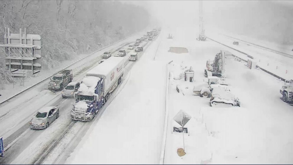
You're still sore about the Cannonball. We should have done it in the middle of the snowstorm in Virginia that shut down I-95.I give up. You people suck.
Don't know, ask #'s!
LOL.
The old "I'm rubber, you're glue" comeback.
This "Hillsborough Deli" bit really is way played out.
But the hookers always tell me 1-3" is average.
Speaking of played out...

They're just telling you that to make you feel good. And they're hoping your monetary tip is bigger than your other one.But the hookers always tell me 1-3" is average.
True, we do. But not in the same way as the Hillsborough MILFs.I give up. You people suck.
Yes, Spanky, that was both the implication and the joke. Which, you know, would've been funnier if NOT explained explicitly.They're just telling you that to make you feel good. And they're hoping your monetary tip is bigger than your other one.

Yes, Spanky, that was both the implication and the joke. Which, you know, would've been funnier if NOT explained explicitly.
I literally almost "pulled a Spanky" and typed a reiteration of your comment before realizing it was adding no value.
And by "literally", I meant "figuratively", but through common usage, "literally" literally means "figuratively".
I love the weather threads as many of us do. If #’s is correct that ‘s great and if he’s wrong so what. As long as he enjoys doing it then should as well.
I love the weather threads as many of us do. If #’s is correct that ‘s great and if he’s wrong so what. As long as he enjoys doing it then should as well.
https://www.popsugar.com/celebrity/Little-Kids-Arguing-About-Raining-vs-Sprinkling-Video-35803364
Yes, Spanky, that was both the implication and the joke. Which, you know, would've been funnier if NOT explained explicitly.
Sorry, I didn't realize that was a joke. I know you're a little slow, so was trying to clarify the situation for you.
What about the coke and hookers bit?This "Hillsborough Deli" bit really is way played out.
@mildone
 or the violating of innocent sheep??
I see someone else commented on it as well…oops
Last edited:
What about the coke and hookers bit?
@mildone
I see someone else commented on it as well…oops
I consider it a different thing. Hookers and blow are real. So are sheep. The Hillsborough Deli and all corresponding "MILFs" are entirely fictitious.
Models not that great for moderate snows. There are hints on some models of potential of some heavier banding setting up. Where and even if it happens is pretty unknown.
some models are pretty tragic like the Ukie

the just in 12z euro rather meh with totals

the gfs similar to the Euro with amounts

NAM also not that enthused

some models are pretty tragic like the Ukie
the just in 12z euro rather meh with totals
the gfs similar to the Euro with amounts
NAM also not that enthused
Blasphemy!The Hillsborough Deli and all corresponding "MILFs" are entirely fictitious.
You're just not using the right entrance.
And set...
Basically looking a window of an 8 hour snow sometime between 10PM Thursday and 7 AM Friday
based on CURRENT modelling, thinking of 1-3 inches and 2-4 in certain areas with some higher amounts of possible with banding and some higher ratios but might be too early to pin that down. Some places will do better than others. The chances of a widespread regionwide 4-6 or even 8 inches that was hyped earlier are much less at the moment.
based on CURRENT modelling, thinking of 1-3 inches and 2-4 in certain areas with some higher amounts of possible with banding and some higher ratios but might be too early to pin that down. Some places will do better than others. The chances of a widespread regionwide 4-6 or even 8 inches that was hyped earlier are much less at the moment.
For winter storms inside 48 hours, I like the NAM.
when the NAM isnt even aroused enough to spit out its usually overdone totals its usually onto something.
Latest
-
01
 The Knight Report
Rutgers vs Northwestern odds: Point spread released on Scarlet Knights, Terrapins
The Knight Report
Rutgers vs Northwestern odds: Point spread released on Scarlet Knights, Terrapins
-
02
 The Knight Report
Join The Knight Report TODAY and get it for 60% off!
The Knight Report
Join The Knight Report TODAY and get it for 60% off!
-
03
 The Knight Report
Rutgers Basketball vs. St. John's | Postgame Reaction & Analysis - TKR Pod
The Knight Report
Rutgers Basketball vs. St. John's | Postgame Reaction & Analysis - TKR Pod
-
04
 The Knight Report
Rutgers Basketball HC Brandin Knight's St. John's Postgame Press Conference
The Knight Report
Rutgers Basketball HC Brandin Knight's St. John's Postgame Press Conference
-
05
 The Knight Report
Rutgers Basketball falls to St. John's in 4OT exhibition marathon
The Knight Report
Rutgers Basketball falls to St. John's in 4OT exhibition marathon